
Walk a Federal Way Street
A street-by-street search works best as a chain of records. King County maps an address to a parcel, the Assessor identifies the taxpayer and legal description, and recorded documents show how interests in that land changed. Federal Way permits add work and inspection dates. Historical reverse directories may name an occupant, but only when a regional volume includes the street. Washington voter information has a separate legal process and does not function as an open web street browser.
Keep the difference between ownership and residence clear. A deed can name a buyer. An assessment can name a taxpayer. Neither proves that every named person lived there, or that no one else did. The most reliable Federal Way street directory entry is therefore a documented set of sources rather than one unqualified name.
- Normalize the address, then search King County eReal Property. Save the situs address, taxpayer, ten-digit parcel number, and legal description.
- Open Parcel Viewer. Trace the street segment, check adjoining parcel shapes, and open Property Reports without treating approximate map lines as a survey.
- Use each parcel number in the Recorder index for recent documents. Where lawful voter data is needed, follow the county request process rather than trying to browse other voters through VoteWA.
- Search deeds by parcel, party name, or legal description. Record grantor, grantee, instrument number, date, and the description tied to each parcel.
- For an older occupant, test reverse directories and census material. Confirm that the volume actually covers the Federal Way area and the address form used in that year.
Federal Way Street Directory Fields
The Assessor is the practical first stop because eReal accepts the kinds of facts an address researcher is likely to know. Results can connect a Federal Way situs address to a parcel number, taxpayer mailing address, legal description, value, recent sales, building traits, units, levy code, districts, and some tax-relief flags. A mailing address is where tax notices go. The situs address is the physical property location. They can be different.
| Search control | Input | Useful result | Federal Way caution |
|---|---|---|---|
| Address | Street and unit | Situs, PIN, property report | Try full and abbreviated suffixes |
| Parcel number | Ten-digit PIN | Exact tax parcel | Enter without symbols in linked systems |
| Owner or taxpayer | Name and variants | Matching assessment accounts | A name does not establish occupancy |
| Condo or apartment | Complex name | Associated units or parcels | One site may contain many households |
| Districts report | Result link | Planning and administrative areas | Postal city and city limits may differ |
The Assessor also answers questions by phone at 206-296-7300. That channel is useful when an autocomplete match fails, a parcel has been split, or the street form differs from the current county record.
Map Federal Way by Street
Parcel Viewer is better than a guessed run of street numbers. Search an address, PIN, or condominium name, then zoom until parcel lines appear. A single click opens links to the Property Report and Districts Report. For a longer segment, the selection tools accept a line, freehand line, polygon, or freehand polygon. A selected parcel can also be buffered by a distance in feet, and the result table can be exported.
King County iMap adds intersection search, place and landmark search, aerial basemaps, and layers for zoning, flooding, planning, political boundaries, and natural resources. Parcel lines are approximate. Use the recorded plat or survey when the boundary itself matters.
View the official Parcel Viewer interface used for the Federal Way street directory map step.
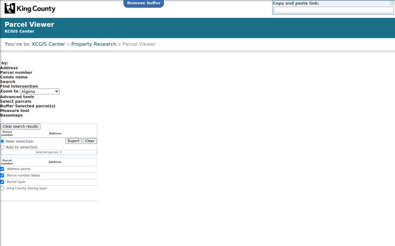
The parcel map turns one address into a verified group of PINs, which can then be checked one by one in assessment and deed records.
Federal Way Street Directory Terms
Four terms prevent many false matches in a by-address search. Record them exactly as the county displays them, especially when a road name or street number has changed.
- Parcel
- A defined unit of land with a King County identification number. One street address can relate to more than one parcel.
- Situs address
- The physical location label for the property, distinct from the taxpayer's mailing address.
- Plat
- A recorded map that divides land into lots, blocks, tracts, streets, or easements.
- Criss-cross directory
- A historical directory arranged by street and address instead of only by a resident's surname.
No official source reviewed identified a single Federal Way street-renumbering project or year. For an address that disappears, compare the subdivision plat, county road maps, GIS address points, USPS form, and historical street index. Do not invent continuity between old and new numbers.
Federal Way Records by Address
No single office maintains a current list of everyone on a Federal Way street. The useful sources are indexed in different ways and have different time spans. The table separates what is directly searchable by address from what needs the parcel or a formal request.
| Address-linked source | Official keeper | Street evidence | How to reach it |
|---|---|---|---|
| eReal assessment | King County Assessor | Owner or taxpayer, situs, mailing address, PIN, legal and sales | Online or 206-296-7300 |
| Parcel Viewer and iMap | King County GIS | Parcel shapes, address points, zoning, reports and exports | Free public viewers |
| Recorded deeds and liens | King County Recorder | Parties, dates, document type and legal description | Landmark, counter, phone, mail, or Archives |
| Permit and code files | Federal Way or King County | Work, project, application and inspection dates | City portal for 1990 onward; county before February 1990 |
| Voter report | King County Elections | Fields Washington law permits for disclosure | Records request; protected fields omitted |
| Reverse directory | Library or archive collection | Past address-to-occupant snapshot when covered | Research room, library staff, or database |
The PIN is the strongest bridge. It survives spelling differences and links a map selection to an assessment. The legal description then carries the search into plats and recorded instruments. Street text remains useful for permits and reverse directories, but it should be checked against the parcel identity.
Federal Way Street Deed Records
The Landmark Web index has no street-address field. Copy the first ten parcel digits from Parcel Viewer, then use Parcel ID for records from 1997 forward. For the online years before 1997, switch to a party name, recording number, book and page, date, or legal search. Most documents recorded from August 1, 1991 forward are online. Earlier material is on microfilm at King County Archives.
Open a likely deed and save its recording number, date, document type, grantor, grantee, and legal description. The grantor transfers an interest; the grantee receives it. Images in the index are not certified true copies. The Recorder sells uncertified and certified copies online, accepts phone orders at 206-477-6620 on weekdays from 9 a.m. to 2 p.m., and accepts mail requests at 201 S. Jackson St., Suite 204, Seattle, WA 98104. The counter is open weekdays from 8:30 a.m. to 4:30 p.m.
Open the King County recording search before reviewing the captured entry screen.
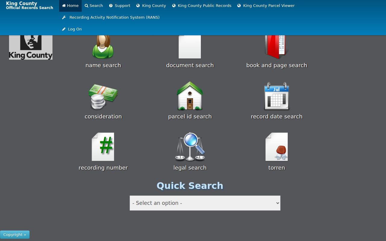
The distinct search tiles show why a street name alone will not retrieve a Federal Way deed chain.
Note: Landmark sorting and filters must be set again on each result page, so save source details as the chain progresses.
Federal Way Street Permit Records
Permit records add dates and project context that deeds do not. Federal Way handles city permit records from 1990 onward and routes historical permits before February 1990 to King County Permitting. That break tracks incorporation and matters for any long street. The correct custodian depends on both the date and whether the parcel was inside the city jurisdiction at the time.
The Federal Way Permit Center accepts electronic work and links an archive for past residential electrical, mechanical, plumbing, and most commercial electrical permits. For a public-record request, give the exact site address, PIN, permit type, document title or report number, and a narrow date range. The city says its preferred request portal is not the only channel: a request can also arrive in person, by mail, email, fax, or phone and will be entered in the portal.
City staff can be reached at permitcenter@federalwaywa.gov or 253-835-2607. Published public hours are 9 a.m. to 4 p.m. Monday, Tuesday, Thursday, and Friday; Wednesday is closed to the public. A permit applicant may be an owner, contractor, or other party, so that name is evidence of a project role, not proof of residence.
Federal Way Street Voter Records
Washington law permits disclosure of specified voter fields, including a registered name, residence address, year of birth, and voting history. It withholds a full birth date, driver's-license information, Social Security information, and protected records. VoteWA is designed for voters to check and manage their own registration, not as a public Federal Way street directory.
A lawful report should go through King County Elections or the state request path under election law and the Washington Public Records Act. Ask for a defined geographic scope and fields, then honor all restrictions and redactions. Safe at Home substitute addresses and other protected entries must remain protected. A voting-history field says whether a ballot was credited, not how a person voted.
Older Federal Way Street Directory
Reverse, or criss-cross, directories are the address-to-name layer for past Federal Way streets. Seattle's official property-history guidance documents reverse lookup beginning in the 1938 era. The documented regional shelf includes Seattle directories from 1890 to 1990, but no source reviewed proves that every Federal Way street appears in every volume. Test the street index, nearby community headings, and the postal or county label used at that date.
Federal Way did not incorporate until 1990, and its name first gained public use through the 1929 school-district consolidation. Earlier records may sit under Redondo, Dash Point, Five Mile Lake, Lakota, or unincorporated King County. KCLS branch staff can make local-history referrals. Seattle Public Library, the University of Washington, Seattle Municipal Archives, King County Archives, and the Historical Society of Federal Way are the documented fallback chain.
The historical collections and their reading conventions belong on the Federal Way city directory page. For street work, capture only the exact year, address, printed occupant, page, and volume coverage needed to check the parcel trail.
Federal Way Recording Alerts
King County highlighted its free Recording Activity Notification System in 2026. RANS can email a subscriber when a land-record document matches a registered personal name, business name, or parcel number. The parcel entry uses the first ten digits. It is useful after a street directory search has established the correct PIN.
The alert is not a fraud-prevention guarantee and does not block a filing. Treat it as notice to inspect a new instrument promptly. Registration asks for confirmed name and email fields, a language choice, and optional parcel information. It connects current monitoring to the same parcel key used in the Assessor, Parcel Viewer, and Landmark.
Federal Way Street Search Limits
Public property rolls do not reliably name renters or every household member. A parcel may contain several units, a taxpayer may receive notices elsewhere, and a buyer may not move in on the deed date. DMV address data is closed by federal law. Utility customer lists are not city records, and Federal Way routes water and sewer questions to Lakehaven while electric and gas records belong to the service provider.
A map result also needs care. Parcel Viewer lines are approximate, ZIP labels are mail geography, and a Federal Way mailing address can fall outside the incorporated boundary. Use city GIS for jurisdiction, USPS for mail form, and the recorded legal description for title. Commercial compilations may merge old and current people, so they cannot repair these limits or prove residence.
Lawful use. Use Federal Way address records only for lawful personal research, property history, and civic understanding. Never use a street search to stalk, harass, intimidate, or harm a person.
A current owner, a past grantee, a permit applicant, and a directory occupant can all be different people. State the record and date found instead of turning any one result into a claim about who lives there now.